WEATHER
Power outages, rain and snow affect Thursday morning commute
Dec 9, 2021, 8:48 AM | Updated: 8:52 am

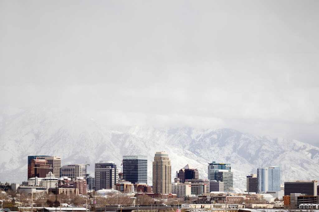
Rain changed to snow early on Thursday, Dec. 9, 2021, at the Utah State Capitol. Photo: Nick Wyatt, KSL NewsRadio

SALT LAKE CITY — Rain and snow combined for a messing morning commute across the Wasatch Front Thursday morning, as drivers adjusted to the first true valley winter storm of the season.
Tune to KSL NewsRadio 102.7 FM/1160 AM or get the app to stream online for the latest conditions.
Commute begins with rain, changes to snow on Wasatch Front
By 8:30 a.m., rain changed to snow at Salt Lake City International Airport, and drivers on the valley’s east benches reported snow sticking to roadways during their commute.
All snow now at the SLC Airport. Expect the remainder of the SL Valley to largely change to snow through 9-10 AM. #utwx
— NWS Salt Lake City (@NWSSaltLakeCity) December 9, 2021
Some 2,400 Rocky Mountain Power customers lost power in Taylorsville and West Valley City, causing headaches for drivers as stoplights along busy routes like 3500 South stayed dark.
We are aware of a power outage impacting 2,402 customers in Taylorsville and West Valley City, UT. We have dispatched crews to investigate and make repairs. The estimated time of restoration is 11:00am. To report your outage text “OUT” to 759677.
— Rocky Mountain Power UT (@RMP_Utah) December 9, 2021
Trouble spots north, east and west of Salt Lake City
In Morgan, a bus rolled over, though no one suffered any injuries.
Ahead of the storm, Tooele School District officials announced a day of online learning for schools in Dugway. No other schools announced plans to delay, cancel or move to remote learning.
DUGWAY SCHOOLS ONLY- Students/staff at Dugway Schools will not attend in-person & will move to online learning due to incoming winter weather conditions. All other schools in TCSD are expected to be on a normal schedule.
— Tooele Schools (@tooeleschools) December 8, 2021
To the east of Salt Lake City, snow obscured the commute over Parleys Summit starting as early as 5 a.m.
BIIIIG flakes flying near Parley’s Summit!! ❄️ ❄️ ❄️ @jedboal @KSL5TV pic.twitter.com/qDAgRlzLQD
— Sean Moody (@SeanMoodyPhoto) December 9, 2021
Current view near Bear River Drive on I-80 in Evanston. Prepare for chain restrictions and winter driving conditions along I-80 in Uinta County, WY. #utwx #wywx pic.twitter.com/FhR65RE9Tw
— NWS Salt Lake City (@NWSSaltLakeCity) December 9, 2021
KSL meteorologist Grant Weyman forecast more snow overnight Thursday into Friday morning. You can find the latest forecast information at kslweather.com.
Contributing: Nick Wyatt, Kira Hoffelmeyer and Sean Moody